


Compostelle 2 morille

eric1955
User

Length
32 km

Max alt
1150 m

Uphill gradient
428 m
Km-Effort
37 km

Min alt
896 m

Downhill gradient
450 m
Boucle
No
Creation date :
2017-03-21 00:00:00.0
Updated on :
2017-03-21 00:00:00.0
6h24
Difficulty : Easy

FREE GPS app for hiking
 SityTrail
IGN / Geographical institutes
SityTrail Plus
The world is yours!
About
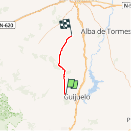
Trail Other activity of 32 km to be discovered at Castile and León, Unknown, Fuenterroble de Salvatierra. This trail is proposed by eric1955.
Positioning
Country:
Spain
Region :
Castile and León
Department/Province :
Unknown
Municipality :
Fuenterroble de Salvatierra
Location:
Unknown
Start:(Dec)
Start:(UTM)
268763 ; 4494041 (30T) N.
Comments